File:Satellite image of Falkland Islands in November 1999.jpg
Jump to navigation
Jump to search
No higher resolution available.
Satellite_image_of_Falkland_Islands_in_November_1999.jpg (339 × 230 pixels, file size: 17 KB, MIME type: image/jpeg)
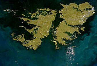
Satellite image of Falkland Islands in November 1999. Cropped image, original taken from NASA's Visible Earth http://visibleearth.nasa.gov/view_rec.php?id=823[dead link]
| Camera location | | View this and other nearby images on: OpenStreetMap |
|---|
| This file is in the public domain in the United States because it was solely created by NASA. NASA copyright policy states that "NASA material is not protected by copyright unless noted". (See Template:PD-USGov, NASA copyright policy page or JPL Image Use Policy.) | ||
 |
Warnings:
|
File history
Click on a date/time to view the file as it appeared at that time.
| Date/Time | Thumbnail | Dimensions | User | Comment | |
|---|---|---|---|---|---|
| current | 14:13, 7 April 2005 | | 339 × 230 (17 KB) | Hautala | {{PD-USGov-NASA}} Satellite image of Falkland Islands in November 1999. Cropped image, original taken from NASA's Visible Earth http://visibleearth.nasa.gov/view_rec.php?id=823 |
Pages using this file
The following page uses this file: